
You can tell by its ramrod straight design that the Rushall Canal was a late arrival, opened in 1847 to connect the Tame Valley Canal with the collieries and brickworks lining the Daw End Branch (opened 1800) and bring coal from the Cannock mines to Birmingham. Your walk starts at Rushall Junction, a fairly desolate location where rubbish boats used to congregate before tipping their cargo over the Tame Valley Canal embankment.


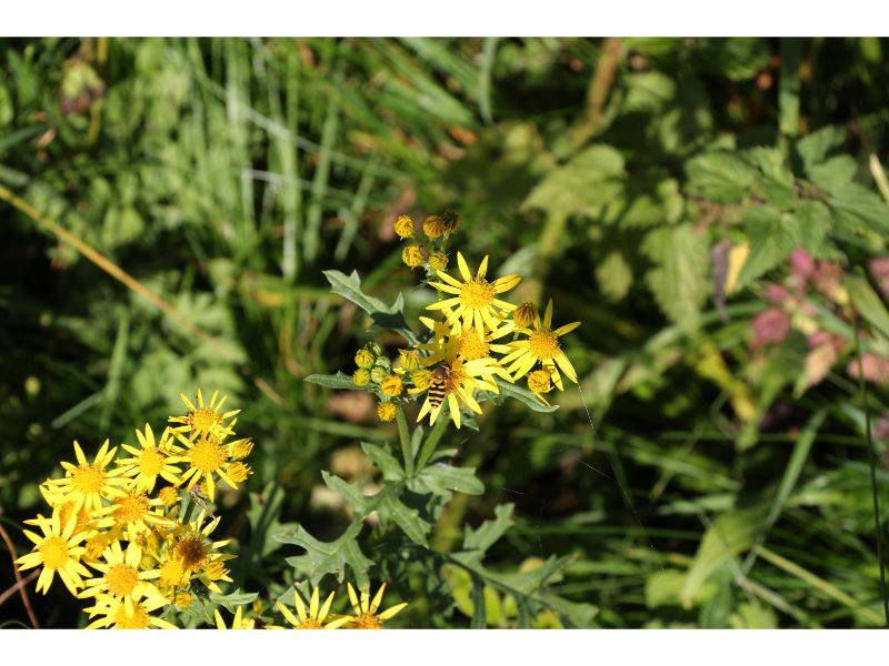


Disappearing under the M6 Viaduct bridge, happily the tow path is well made, but this does have the downside of also attracting speeding cyclists. Progress is swift and you are soon rewarded with countryside views following Biddleston Bridge. Willow-herb, ragwort and clover line the tow path, and in the autumn the hedgerows are full of hawthorn berries, blackberries, and black bryony. Cycle path 5 leaves at Hill Farm Bridge and the tow path, although perfectly walkable, is no longer gravelled. Motorway noise is still apparent but there are now ducks quacking among the discarded crisp packets. The pleasantness continues when reaching the first of nine Rushall Locks that will lift the canal from the 408ft Walsall level to the 473ft Wolverhampton level.
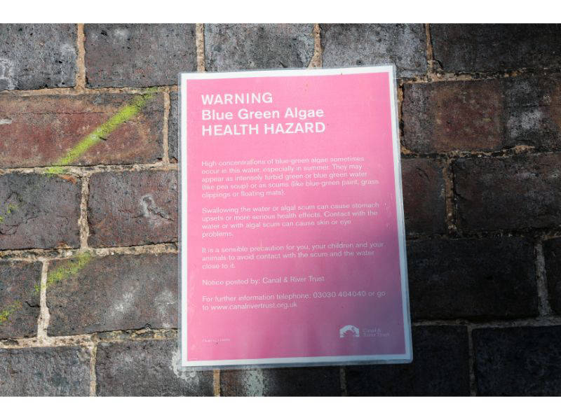
The initial locks are known as the ganzy seven because, possibly due to their exposed nature, the original boatmen found this item of clothing necessary to keep warm. Water levels are a recurring problem along the locks and sure enough below Lock 5 the pound is bone dry. More unusual is the complete set of clothes neatly stacked next to lock 4. Above lock 3 the water is covered by an odd green substance which continues unabated for a considerable distance and undisturbed by boats that are strangers in these parts. The local residents do take advantage of the canal however with chairs, tables and more elaborate leisure constructions.
You get a good idea of the arrow straightness of the canal from under Sutton Road Bridge and Moat Bridge. Following a gap of over a mile, with the canal bordering Walsall Arboretum, you reach Lock 2 where there's even a boat but it doesn't seem to have moved for some time. The attractive cottage at Top Lock is worth a photograph and then there's the Longwood Boat Club that occupies what's left of the Hay Head Branch at the eponymous junction. Abandoned in 1954, the branch once serviced extensive local limestone workings.
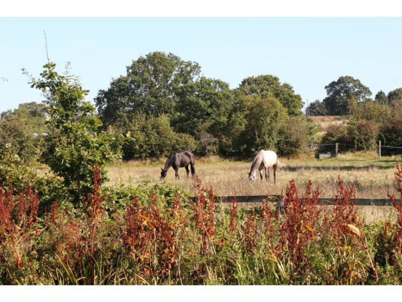
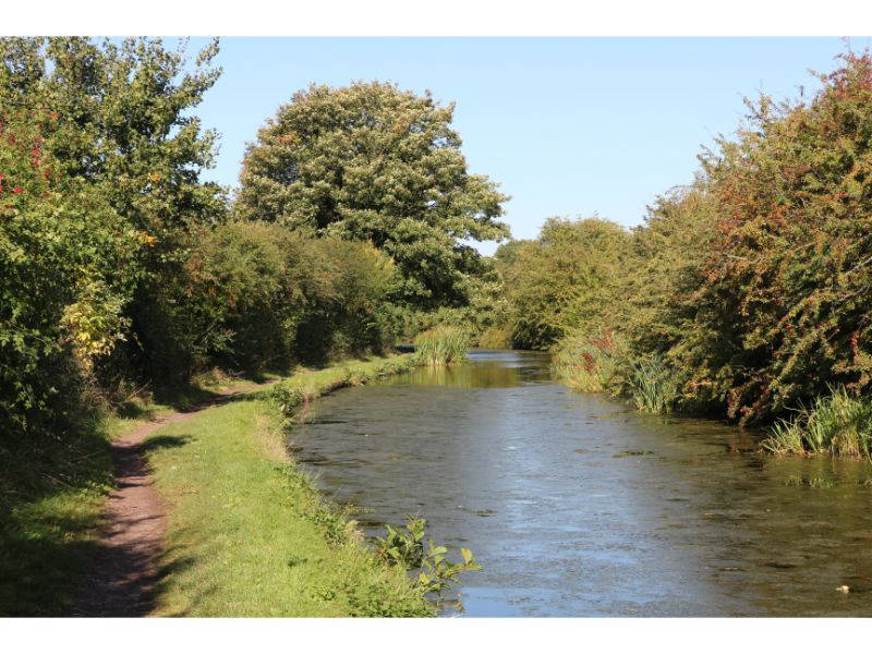
Emerging from under Longwood Bridge is a revelation and you immediately realize the difference between an old contour canal - the Daw End Branch Canal that you are now walking alongside – and the 'modern' Rushall Canal that had cut straight through the countryside for the last 2¾ miles. Green fields with bales of hay and grazing horses now decorate the view as the canal twists and turns with water that's crystal clear and full.
The Daw End Branch Canal connected with the Wyrley and Essington Canal and was built to transport limestone from Hay Head to be used as flux in Black Country iron works and to manufacture cement. Worked since the 16th century, the limestone was renowned to be of very superior quality and 'inexhaustible in quantity'. After Riddian Bridge and before a railway viaduct, on the tow path side there's the Park Lime Pits Country Park, an indication that you are indeed now in limestone country with thick seams lying deep underground.
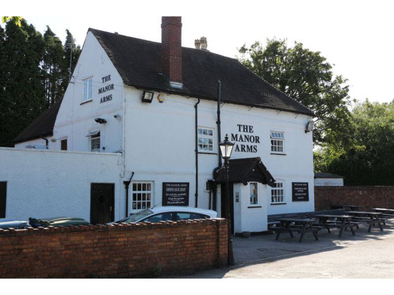
Just after the viaduct taking you over the current Sutton Park Line (opened in 1879 but now only carrying freight) you have two refreshing choices, either the Manor Arms or the Boathouse. The former has been around for much longer than the canal, licensed to sell beer since 1248, it's famous for having no bar.
The Phoenix Lime Works (closed 1918) stood opposite these pubs and around the next corner there was the Winterley Lime Works. Still countryfied in a kind of BCN way, the canal takes on a slightly more urban feel and after Brawns Bridge there is an incongruous line of leylandii. Before too long you become hemmed in by factories on extensive industrial estates. One occupies the site of the former Linley Cement Works in whose limestone caverns the RAF chose to store bombs during the Second World War. The industrial landscape will continue with factories on both sides for over two miles. They are partially screened by trees as you go under a brutalist concrete pipe bridge and then get to the equally unlovely Hopley('s) Bridge. Following narrows marking the site of the former Tongues Meadow Bridge, there are playing fields providing a little breathing space before Aldridge Wharf Bridge.
Many of these factories have been built on green field sites but the stretch following Aldridge Wharf Bridge has a long industrial history and was packed with brick works such as the Victoria, Northywood and Atlas that took advantage of the excellent quality local clay. Running parallel with the canal is Brickyard Road where Ibstock still carry on the tradition occupying the site of Aldridge Brick and Tile works which produced the extremely hard Utopia bricks, so tough that they were a popular choice for constructing air raid shelters.
On the tow path side just before the demolished Barnfield Bridge there's the entrance to an old basin that served Coppy Hall Colliery, the Leigh's Wood Branch of the L&NWR also crossed at this point serving Leigh's Wood Colliery (closed 1881), Coppy Hall (closed 1909) and various local brick works. You're above a huge quarry where building materials are still manufactured on the the site of the Springfield brick and tile works but all the collieries including Aldridge were gone by the 1930s.
The Breedon gravel tow path laid in 2003/4 makes progress easy but the environs aren't quite so easy on the eye with industry continuing to provide a backdrop to the CRT Winter Moorings near Northywood Bridge. Here you'll discover the small but nicely formed Aldridge Marina which occupies an old Aldridge Colliery basin. There's a further quarry on the left before the canal turns sharply at Lathams Bridge, this was the Empire brick and tile works now used as a landfill site,. Under the bridge there's a scrawled warning that you'll be robbed if found there after 7.00pm, this brings to mind the Simon & Garfunkel lyrics 'the words of the prophets are written on subway walls' and usefully there's also a phone number if you require sex or drugs. Smart apartments line the canal between here and Hollanders Bridge.
Continuing along the high embankment, factories give way to housing as you near the eye catching Black Cock Bridge, a name you wouldn't get away with nowadays. Due to mining subsidence this is a flat top rather than the normal brick hump back bridge and has had to be heightened several times to compensate for it sinking. For the same reason, the canal is particularly deep at this point. Living near the bridge isn't recommended as, because of the blind summit, there is a continual blast of car horns. The canal now skirts Walsall Wood with factories again dominating, keen eyes may just see the entrances of old basins that served Walsall Wood Colliery which was digging out coal from here until 1964.
The Wyrley and Essington Canal is finally reached when, after Clayhanger Bridge, the wide canal squeezes through Catshill Narrows to Catshill Junction and you have the choice of turning left towards Wolverhampton or right to Ogley Junction and then hopefully in the future to Huddlesford Junction on the Coventry Canal, this section of the canal closed in 1954 and is currently under restoration.
Follow this walk on YouTube